Bin Salman Surveying is still here today to serve our clients. Land surveying services include:
| |
Topographic Surveys
Monitoring
Construction Surveys
Boundary Surveys
|
Tower Sites
Subdivisions
Legal Description (Demarcation)
Improvement Location Certificates |
As-built Surveys
Global Positioning Systems Services
Drafting Services (AutoCAD)
As-built Surveys |
Other Surveying Including:
| |
Gate level competition
Float Survey
Gudatic Survey
Hydrographic Surveying
(Bathemetry)
Arial Survey
|
Profiles and Cross sections
Boreholes
Volume Calculation
Roads
Pipelines |
|
Survey Types
The word "survey" has become a well-used term for various types of work, which are not legal property surveys. A legal property survey is a survey where property corners have been set, or found and duly recorded. A survey plan with a registered land surveyor's certificate is required on all legal property surveys.
Often work is performed to meet a landowner's need but does not meet the required criteria of a legal survey. This can lead to confusion. Below are descriptions to help you understand the differences:
Boundary Survey
A boundary survey establishes the true property corners and property lines of a parcel of land. Boundary surveys are typically performed to obtain building permits, to resolve property disputes, and for erecting fences. Easement lines may also be located, if requested, with this type of survey.
Cadastral Survey
Original survey, resurvey, or retracement of public lands within the public land survey system of the Emirates of Dubai for restoration of property lines.
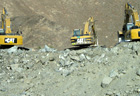
Construction Survey
Survey measurements made prior to or while construction is in progress to control elevation, horizontal position, dimensions, and configuration, i.e. stakeout of line and grade for buildings, fences, roads, etc.
Control Survey
A Land Survey providing precise locations of horizontal and vertical positions of points for use in boundary determination, mapping for aerial photographs, construction staking or other needs.
Geodetic Survey
A Land Survey which is affected by and takes into account the curvature of the earth and astronomic observations.
GIS and LIS Surveying and Mapping
Geographic Information Systems and Land Information Systems.
Hydrographic and Underwater Surveys
Collect data relating to bodies of water, and may include the water depth, bottom contours and configuration, directions and velocity of current, heights and water stages, and the location of fixed objects for navigational purposes.
Site Plan Survey
A combination of boundary and topographic surveys for preparation of a site plan to be used for designing improvements or developments, and obtaining government building permits.
A survey performed to obtain horizontal and or vertical dimensional data so that a constructed facility may be delineated, i.e. foundation survey, or as-built of improvements. Specifically, an As-Built Survey is a survey to physically locate structures and improvements on a parcel of land, generally for
mortgage purposes. This does not always include boundary monumentation.
Route Survey
Reconnaissance, preliminary survey and location survey for an alignment or linear type feature such as a road, railroad, canal, pipeline or utility line.
Site Plan Survey
A combination of boundary and topographic surveys for preparation of a site plan to be used for designing improvements or developments, and obtaining government building permits.
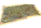
Subdivision Survey
Also known as a “Subdivision Plan”, it is the subdivision of a tract of land into smaller parcels, showing monumentation and mathematical survey data on a map, conforming to local Government ordinances.
Topographic Survey
A Land Survey locating natural and man made features such as buildings, improvements, fences, elevations, land contours, trees, streams, etc. This type of survey may be required by a government agency, or may be used by Engineers and/or Architects for the design of improvements or developments on a site.
|